NESKOWIN AND CASCADE HEAD BIOSPHERE RESERVE
Cascade Head Folklore
Biosphere Reserve Information
CASCADE HEAD
The Cascade Head Biosphere Reserve and Experimental Forest is situated 136 km south-west of Portland on the Pacific Coast. The Experimental Forest was established in 1934 for scientific studies of typical coastal Sitka spruce (Picea sitchensis) and western hemlock (Tsuga heterophylla) forests found along the Oregon Coast. Since then, the forest stands have been used for long-term studies, experimentation, and ecosystem research.
Ecosystems represented in the biosphere reserve are very diverse. Two major prairie headlands jut out into the Pacific Ocean. The recently restored Salmon River estuary provides a critical juncture between fresh and salt water and maintains staging areas for upstream spawning migrations of anadromous fish and rearing areas for juveniles and smolts. The forested ecosystems include very productive young and mature (150 year-old) stands of Sitka spruce-western hemlock and Douglas fir (Pseudotsuga menziesii) forests with riparian areas and stream banks dominated by red alder. Spotted owl, marbled murrelet, coho salmon and Oregon silver spot butterfly are four federally listed endangered species that occur in the biosphere reserve.
Approximately 30 percent of the Experimental Forest has been subject to logging and 60 km of road has been constructed as part of research and experimentation on silvicultural practices. The Scenic Research Area has been subject to varying degrees of human modification from little to substantial (e.g. residences, diking of marshlands, clearing for agriculture).


| Major ecosystem type | Sub-tropical and temperate rainforests; restored estuary | ||
| Major habitats & land cover types | Sitka spruce western hemlock forests; high salt marshes | ||
| Location | 45°02’N, 123°59’W | ||
| Area (hectares) | |||
| Total | 7,051 | ||
| Altitude (metres above sea level) | 0 to +525 | ||
| Year designated | 1976 | ||
| Administrative autorities | Cascade Head Experimental Forest and Scenic Research Area U.S. Department of Agriculture, Forest Service | ||
| Brief description | Growth and mortality patterns of 130 year- old stands of Sitka spruce, western hemlock, and Douglas fir Air temperature and precipitation data (56 years) Salt marsh restoration (since 1981) Salmonid use of restored salt marsh Relation of chloride and nitrogen in forest soils to water chemistry |
||
| Specific variables… | |||
| Abiotic | Abiotic factors, air temperature, meteorology, soil. | ||
| Biodiversity | Fishes, forest systems, restoration/rehabilitation/redevelopment, wetlands. |

Pacific Northwest Research Station
Introduction Cascade Head Experimental Forest, located on the central Oregon Coast, was established in 1934 to represent typical Sitka spruce-western hemlock forests. The Neskowin Crest Research Natural Area was established in 1941 in the northwest corner of the experimental forest. In 1974, an act of Congress established the Cascade Head Scenic Research Area, which includes the western half of the experimental forest. The designation added several prairie headlands, the Salmon River estuary (the only estuary on Forest Service lands in the conterminous United States), and contiguous private lands to the mature forest ecosystems already part of the experimental forest. The result has been a more diverse and coastal-related research program. Together, the experimental forest and the scenic research area were designated a Biosphere Reserve as part of UNESCO’s Man and the Biosphere program in 1980. The ecosystems here are home to more than 350 species of wildlife. There are four federally listed endangered species that use or inhabit the Cascade Head area: spotted owl, marbled murrelet, coho salmon, and Oregon silver spot butterfly. The recently restored Salmon River estuary provides a critical juncture between fresh and salt water, supports numerous forms of life, and maintains staging areas for upstream spawning migrations of anadromous fish and rearing areas for juveniles and smolts.
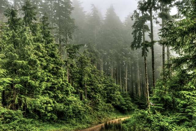
Climate Cascade Head is on the southern end of the coastal temperate rain forest, a 1- to 5-km-wide strip that runs from southeastern Alaska to northern California. Cascade Head has a moderate and very wet climate. Mean annual temperature is 10 °C with minimal seasonal and diurnal fluctuations. Average yearly rainfall is 2,450 mm, though fog drip through the forest canopy may add 500 mm of precipitation a year. Heavy rains and gale force winds blowing off the ocean are common in late fall and winter.
Soils The headlands and ocean-front areas of Cascade Head are mostly basalt. Soils, derived primarily from tuffaceous siltstones, are fine textured, moderately well drained, and deep (100+ cm). Soils under forest stands are fertile and rich in organic matter and contain high levels of nitrogen. Sediments in the estuary reveal surfaces buried from previous earthquakes, the most recent occurring about 350 years ago.
Vegetation When the Cascade Head was established, the area was primarily covered with a forest that grew up after the huge Nestucca Fire of the late 1840s. Stands of spruce and western hemlock that survived the fire are found in the Neskowin Crest Research Natural Area. The Nechesney Indians burned some of the forest close to the ocean in the early 1900s. Some of the more gentle country to the east, homesteaded by European settlers and abandoned in the early 1920s, now supports evenaged, single-canopy forests with dense shrub understories. The forested ecosystems include productive young, mature, and old-growth stands of Sitka sprucewestern hemlock and Douglas-fir forests with riparian areas and streambanks dominated by red alder. Western redcedar is found occasionally. Some of the highest growth rates and greatest volumes per hectare for any temperate forest in the world are reported for this area. Experimental clearcutting, shelterwood cutting, thinning, and salvage from large windstorms have affected about 25 percent of the forested area.
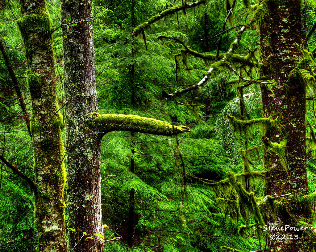
The Salmon River estuary has a history of livestock grazing that goes back to the late 1800s. In the early 1960s, the estuary was diked for pasturage. With the establishment of the scenic research area, the dikes were breached in 1979 and restoration of the estuary begun. Breaching of the dikes was completed in 1997. Previous to dike building, the estuary was dominated by high saltmarsh vegetation; currently, low salt-marsh communities dominate the restored areas. Two grassy headlands are found in the area: Cascade Head itself (owned by The Nature Conservancy) and north of that, the Hart’s Cove headland within the Neskowin Crest Research Natural Area. Both headlands are basaltic intrusions, dominated by grass species (not all native) and fringed by Sitka spruce forest. Species diversity in the area is high, mainly because of the variety of the ecosystems involved. The area is rich in moss and lichen species (more than 90 and 180 species, respectively) and the vascular plant list for all ecosystem types includes more than 400 species.
Long-Term Data Bases A NOAA weather station at Cascade Head has been collecting temperature and precipitation data since 1934. Three state-of-the-art telemeterized weather stations were established in the spring of 2002. The Pacific Northwest Research Station maintains permanent sample plots established in 1935, 1963, and 1979 (in Neskowin Crest Research Natural Area).

Research, Past and Present Early research at Cascade Head includes studies that determined life history and characteristics of native tree species; growth and yield of Sitka spruce-western hemlock, Douglas-fir, and red alder stands; and basic relations between vegetation and climate. From the 1940s through the 1960s, experimental, commercial-size harvesting evaluated the silvicultural and economic results of different cutting methods. Although research in applied forestry has continued over the years, other topics are being studied today, including forest ecosystem productivity, wind disturbance, nutrient cycling, and global carbon cycling. Research on the Salmon River estuary has been ongoing since the first dikes were breached in 1979. Reestablishment of the salt marsh ecosystems continues to be studied, and studies of the use of these restored ecosystems by anadromous fish were initiated more recently.
Major Research Accomplishments and Effects on Management Much of the information for managing Oregon coastal Sitka spruce-western hemlock forests, both young and old, has come from Cascade Head. Long-term plot data and current thinning studies are providing information for how best to accelerate the restoration of coastal forest ecosystems. The area has served for more than 25 years as the end point for the Oregon Transect, a study area that runs from the Pacific Coast east to the desert, crossing numerous environmental gradients and ecosystems. Long-term data are used extensively for modeling purposes. The Salmon River estuary work is seminal in looking at the role of estuaries in the lives of various species of anadromous fish.
Collabrators At Cascade Head, collaborators include The Nature Conservancy, numerous state and private universities, Oregon Division of State Lands, Oregon Department of Fish and Wildlife, National Aeronautics and Space Administration, Environmental Protection Agency, and National Marine Fisheries Board of the Nation Oceanic and Atmospheric Administration.
Research Opportunities The Salmon River estuary is the best example of a restored estuary on the Oregon coast. It provides excellent opportunities to study the relationship of anadromous fish and estuaries. Cascade Head has both mature/old-growth and plantation forests available for study. Both these forest types are important for answering questions posed by the Northwest Forest Plan. The forest contains some of the best remaining and largest extant coastal temperate rain forest left along the Pacific Northwest coast south of British Columbia. Cascade Head is highly visible and accessible to the public for recreation and enjoyment, making opportunities for research on recreation use and social interaction plentiful.
A spectacular coastal headland is a haven for rare plants, wildlife and grassland communities.
10-Day Weather Forecast

Local Weather Conditions

Hiking Information
Maps and Links
Please observe the following guidelines while hiking:
- Stay on the trail. Don’t collect plants, insects or other species or disturb soil, rocks, artifacts or scientific research markers.
- No dogs. Preserves harbor ground-nesting birds and other wildlife that are extremely sensitive to disturbance.
- No bicycles or motorized vehicles. Native plants and research sites are easily trampled.
- No hunting, camping or campfires.
- For groups of 10 or more, please contact us before visiting a preserve (a volunteer naturalist guide may be available).
- Please bring a bag and carry out any trash you find.
- Please report to us any problems you observe (e.g., camping, plant removal, hunting, off-road vehicle damage, etc).

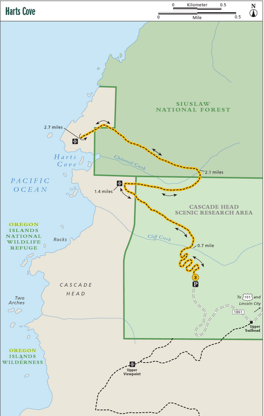
DIRECTIONS
- Head north on US 101 from Lincoln City.
- Just north of the Salmon River, turn west on Three Rocks Road.
- At 2 miles, take the left fork and park in Knight Park.
- The trailhead begins there. It crosses through private and U.S. Forest Service property and over a narrow winding road, so please use caution and respect private property.
- Drive 2.4 miles north of the Salmon River, almost to the summit of Cascade Head.
- Turn left on Cascade Head Road (USFS Road 1861).
- Continue approximately 3.5 miles, bearing left when the road forks. (There is a U.S. Forest Service trail to Harts Cove at the end of this road.)
- The upper trailhead is marked by a small parking lot and sign. At the upper viewpoint, the trail drops steeply 500 feet to connect with the lower trail.